Javascript is not enabled.

Javascript must be enabled to use this site. Please enable Javascript in your browser and try again.

Skip to content
Content starts here
CLOSE ×

Search

Leaving AARP.org Website

You are now leaving AARP.org and going to a website that is not operated by AARP. A different privacy policy and terms of service will apply.

Take a Road Trip and Explore Southwest New Mexico

On this 3-day drive, mysteries of the past linger where the desert meets the mountains

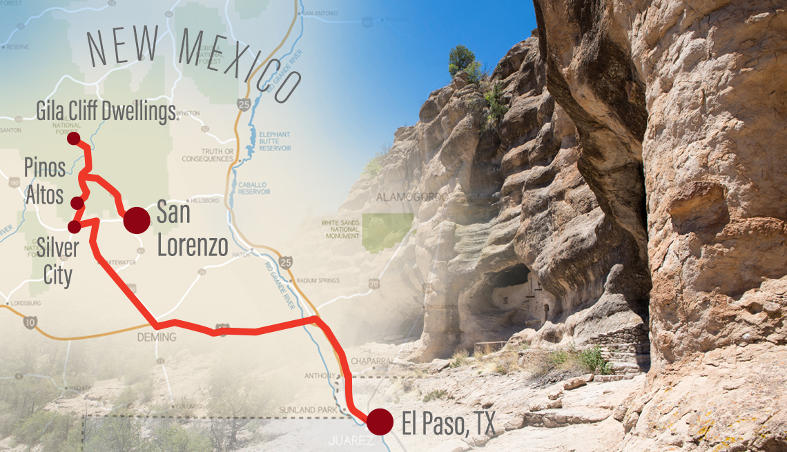
spinner image combined image of a map of new mexico showing the route of a road trip and a photo of the gila cliff dwellings which is a stop along the route
Getty Images/AARP

You'll spend most of your time on this road trip within a compact area nestled in the high desert of Southwestern New Mexico, about two and half hours from El Paso on the Texas border and three hours east of Tucson, Arizona. Each of the three stopover points suggested below have their charms, but you could also make the more bustling Silver City your convenient base and follow nearly the same entertaining itinerary.

COVID-19 update

The unpredictability of the coronavirus means travel restrictions are constantly evolving. Be sure to check New Mexico’s official website for updates before visiting from out of state, and follow CDC guidelines for safe travel.

spinner image Image Alt Attribute

AARP Membership— $12 for your first year when you sign up for Automatic Renewal

Get instant access to members-only products and hundreds of discounts, a free second membership, and a subscription to AARP the Magazine.

Join Now

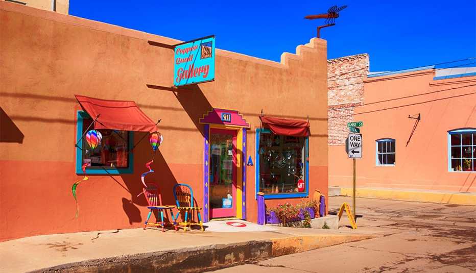
spinner image Outside the Cooper Quail Gallery on the corner of W Yankie and N Texas Street in downtown Silver City NM
Cooper Quail Gallery
Images-USA / Alamy Stock Photo

Day 1: El Paso, Texas, to Silver City, New Mexico (160 miles)

From El Paso, take Interstate 10 West (to Exit 82A) then U.S. 180 W to Silver City. Named for the precious metal discovered behind the present-day Grant County Courthouse, this small mining town of about 9,500 effortlessly combines a palpable Wild West vibe with a vibrant art community. Tucked in the high desert of New Mexico's southwest corner (elevation: 6,000 feet), the childhood home of Billy the Kid at once intrigues and captivates those who stroll its storied streets. Art unfolds long before you enter one of its 20-plus galleries, with more than 70 murals vying for your attention. The work of area teens through the Mimbres Region Arts Council Youth Mural Program, the murals serve as visual history books. Notably, Apache leader Geronimo and Billy the Kid make an appearance on the mosaic murals covering the windows of the old Masonic Temple downtown.

For an afternoon hike, venture to Boston Hill just off Market Street, where 12 miles of trails wind in and around many of the old mines above the city. Recommended for most skill levels, the Boston Hill Trail loops 1.7 miles through the wildflower-strewn terrain, leading to views of the surrounding landscape.

For dinner, sample a New Mexico staple at downtown's Little Toad Creek Brewery & Distillery — the green chile-topped LTC burger. Follow the local lead by washing it down with one of the brewed-on-site craft beers. If you fancy a cocktail with more green chile flavor, the Green Chile Cucumber Gimlet concocted with the distillery's own Green Chile Vodka delivers. The restaurant has reduced its indoor seating to 50 percent capacity; patio dining and takeout also available.

Where to stay: Sleep in Art Deco luxury downtown at the 59-room Murray Hotel in Silver City. Restorations to this 1938 gem made green energy-efficient systems a priority.

See more Health & Wellness offers >
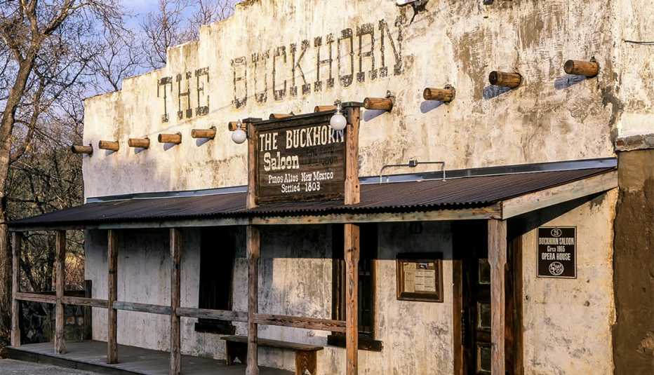
spinner image The Buckhorn Saloon, Pinos Altos Ghost Town, near Silver City, New MexicoÅ
The Buckhorn Saloon
Efrain Padro / Alamy Stock Photo

Day 2: Silver City, Fort Bayard and Pinos Altos (27 miles)

For a light breakfast, stop by the independently owned Javalina coffee shop, where eye-catching art decorates the walls. Sip your morning brew and indulge in a locally made pastry on its outdoor patio. Before departing Silver City, stop by Diane's Restaurant & Deli — a staple for more than 30 years — for to-go sandwiches served on bread baked in-house daily. With your provisions in tow, travel east on U.S. 180 for approximately 9 miles to Fort Bayard Historic District. Established in 1866, the fort served as a military outpost whose troops included the famed Buffalo Soldiers, an all-Black regimen. Interpretive signs share stories of the fort as you walk and drive through the grounds. An easy 5.5-mile round-trip hike through pinon and juniper leads to the country's second-largest alligator juniper, called the “Big Tree.” Break out your sandwiches and dine at a picnic table under the ample shade of the 63-foot-tall tree with a 62-foot crown.

Retrace your route on U.S. 180 W 1.5 miles to Arenas Valley Road. Another mile northward on that road leads to the easy, well-marked 3.5-mile Dragonfly Loop walking trail. Ancient petroglyphs appear in the rocks along the trail.

Continue on U.S. 180 W to N. Mex. 15 N to Pinos Altos. Nestled in towering ponderosa pines and straddling the Continental Divide at 7,840 feet, this 1860s gold mining town appears abandoned at first look, with weathered adobe buildings lining the tiny main street. The don't-miss attraction: Buckhorn Saloon & Opera House, which may seem deserted from the outside, but inside you'll find a well-outfitted bar recapturing the spirit of an old miners’ watering hole. A mecca for steak lovers, Buckhorn grills up some of the best around so plan to stay for dinner; takeout available.

Where to stay: Walking distance from the Buckhorn Saloon and surrounded by the pines, Bear Creek Cabins in Pinos Altos offers 15 two-story cabins with fireplaces.

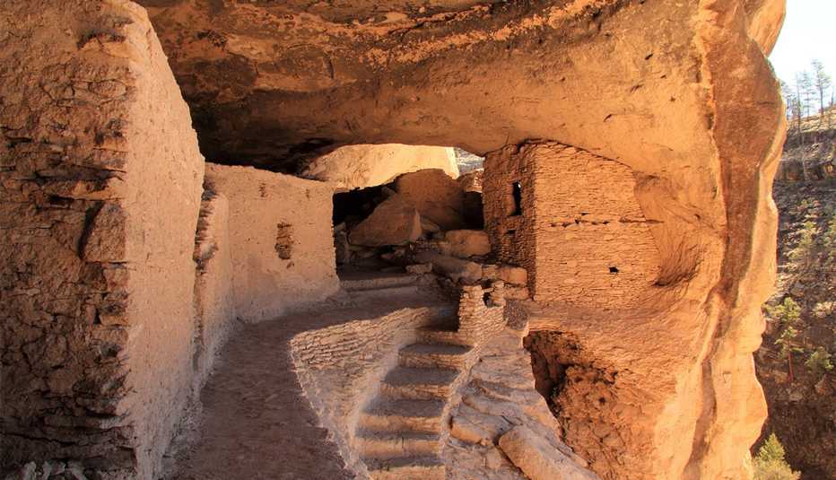
spinner image Ancient Mogollon Ruins at Gila Cliff Dwellings National Monument in the Gila Wilderness, New Mexico
Gila Cliff Dwellings National Monument
Wilsilver77/Getty Images

Day 3: The Trail of the Mountain Spirits Scenic Byway (93 miles)

The Trail of the Mountain Spirits Scenic Byway begins climbing as you drive from Pinos Altos north into the Gila National Forest. Boasting 3.3 million acres of forested hills and majestic mountains, the Gila encompasses the 559,688 acres of the Gila Wilderness, the country's first such designated area. The narrow road winds through the forest offering jaw-dropping views of vertical cliffs and deep canyon walls. Traversing back and forth across the Continental Divide, the byway crosses six climatic zones. Keep an eye out for resident mammals, including beaver, black bear, bobcat, elk, mountain lion and Sonoran white-tailed deer.

The road follows a steep descent at Sapillo Creek (18 miles past Pinos Altos), where it intersects with N. Mex 35 then returns to a climb heading north for 17 miles along a series of steep switchbacks terminating at the Gila Cliff Dwellings National Monument. A stop at the Senator Clinton P. Anderson Scenic Overlook along the way yields glorious views of the Gila Wilderness and the Gila River Canyon lying 2,000 feet below.

As one of the few places visitors are permitted to wander through an archeological site, the monument provides an insightful glimpse into the lives of the people of the Mogollon culture. An easy 1.1-mile hiking trail leads to a series of passageways connecting five intriguing caves consisting of 42 rooms believed to have housed 40 to 50 Pueblo Indians between the 1280s and early 1300s.

Nearby, family-owned and operated Doc Campbell's Post stocks more than groceries, snacks, nonalcoholic drinks and ice cream. You just might leave with some of the beautiful and unique handmade jewelry crafted by Native American artisans. After your unexpected shopping spree, backtrack the 17 miles to Sapillo Creek; then you'll take a new road -— southeast on N. Mex 35. Four miles along, you'll pass Lake Roberts, a lovely manmade lake stocked with trout to the delight of avid fishermen. The byway crosses the Continental Divide a second time before reaching the fertile Mimbres River Valley. Continuing west on N. Mex. 152 at the town of San Lorenzo leads to an overlook into the enormous hole created by the still-active Santa Rita Copper Mine, which dates back to the early 1900s.

Where to stay: At Georgetown Cabins Resort near Mimbres (a tiny town just 5 miles west of San Lorenzo), six solar-powered cabins provide all the amenities of home, including full kitchens and outdoor grills. End your evening on your private patio gazing at the stars blanketing the dark sky above.

Discover AARP Members Only Access

Join AARP to Continue

Already a Member?

AARP Travel Center

Or Call: 1-800-675-4318

Enter a valid departing date

Enter a valid returning date

Age of children:

Child under 2 must either sit in laps or in seats:

Enter a valid departing date

Age of children:

Child under 2 must either sit in laps or in seats:

Enter a valid departing date

Age of children:

Child under 2 must either sit in laps or in seats:

Flight 2

Enter a valid departing date

Flight 3

Enter a valid departing date

Flight 4

Enter a valid departing date

Flight 5

Enter a valid departing date

+ Add Another Flight

Enter a valid checking in date

Enter a valid checking out date


Occupants of Room 1:


Occupants of Room 2:


Occupants of Room 3:


Occupants of Room 4:


Occupants of Room 5:


Occupants of Room 6:


Occupants of Room 7:


Occupants of Room 8:


Enter a valid departing date

Enter a valid returning date

Age of children:

Occupants of Room 1:

Age of children:


Occupants of Room 2:

Age of children:


Occupants of Room 3:

Age of children:


Occupants of Room 4:

Age of children:


Occupants of Room 5:

Age of children:

Age of children:

Child under 2 must either sit in laps or in seats:

Enter a valid start date

Enter a valid drop off date

Select a valid to location

Select a month

Enter a valid from date

Enter a valid to date