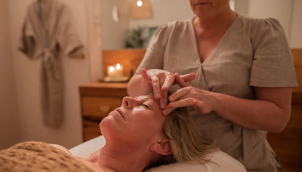
AARP Member
Offline
Background
Gender: Female
Status: Married
Location:
CASA GRANDE, Arizona
United States
Quote:
When the student is ready, the teacher will appear

My Journals (30)


                              DOMESTIC VIOLENCE CLAIMS ANOTHER LIFE

By Carol Ann
 
My heart is really saddened to tell you that a co-worker of mine was  
murdered this past weekend. I don’t live in a high-crime area. This is the first time someone has been murdered since 2006 in Casa Grande according to the local newspaper.
 
The incomprehensible part of this story is the suspected killer was a former boyfriend. This beautiful hospital ultrasound technician just turned 30 years old on Saturday and her life was snuffed out on Sunday. Her killer is still on the run with her car.
 
I knew about her moving to Casa Grande recently according to her, to cut down the commute. No one knew that her beautiful smile and charismatic personality was hiding the sadness of an abusive boyfriend. Although she only was employed for 6 months at my hospital, she was not only technically excellent, but was a people-person and made all of her patients feel at ease.
 
I know exactly how she felt, because I would go to school smiling to escape the hell called home, because of my father’s abusive behavior. The difference is I convinced my mother to move out before someone was killed. Perhaps like so many people in love with a controlling person, she didn’t realize that it could lead to this.
 
The difference is forty years ago when my mother and I ran away, there were no shelters, crisis hotlines, protection from abuse orders or advocates for victims. Divorce was considered a disgrace, so no one would talk about the secrets and the horrors behind closed doors.
 
The first week she worked with me, she came to me and asked if I had any chocolate? Luckily I had a small Hershey bar that I gladly gave her. After that I would occasionally slip some chocolate in her scrub’s pocket. Had I known about her situation, I would have slipped the telephone number of the local hotline for abuse in her pocket too.
 
I beg anyone that suspects that a relative, friend, co-worker or neighbor is in an abusive situation; let them know there is always help. Silence always kills . . . as it did this time too.
* * *
 
Added: November 28, 2008
Views: 48 | Comments: 5 | Bookmarks: 0

A man in Jacksonville calls his son in San Diego the day before

 
Thanksgiving and says, "I hate to ruin your day, but I have to tell you that your
 
Mother and I are divorcing; forty-five years of misery is enough.
 
 
"Pop, what are you talking about?" the son screams.
 
 
"We can't stand the sight of each other any longer," the father says.
 
"We're sick of each other, and I'm sick of talking about this, so you call your
 
sister in Denver, and tell her."
 
 
Frantic, the son calls his sister, who explodes on the phone.
 
 
"Like hell they're getting divorced," she shouts. "I'll take care of
 
this."  She calls Jacksonville immediately, and screams at her father, "You are
 
NOT getting divorced. Don't do a single thing until I get there. I'm calling
 
my brother back, and we'll both be there tomorrow. Until then, don't do a
 
thing,  DO YOU HEAR ME?" and hangs up.
 
 
The old man hangs up his phone and turns to his wife. "Okay,' he says,
 
they're coming for Thanksgiving and paying their own way."
 
(A friend e-mailed my this story.  Hope those of you that have adult children in other states get a laugh from it . . . I did.) 
 
Have a VERY HAPPY THANKSGIVING!
Carol
 
 
Added: November 27, 2008
Views: 44 | Comments: 2 | Bookmarks: 0


THANKSGIVING . . . EXPRESSING GRATITUDE
By Carol Ann (Written 2004)
 
This year, more than any other, I have had an opportunity to look back at a year full of adventures, the beauty of mother-nature, meeting and enjoying the fellowship of other travelers, and surviving life-threatening illness.
 
Jim and I have been truly blessed with 43 years together of ever changing journeys, including 41 years of marriage, 3 healthy sons, and Mike, Jesica, Sophie, Mary Kate, Amanda, Maya, Sarah, Ryan, Tyler and Emily, our 10 grandchildren, all with their own unique talents.
 
Two years ago, Jim asked me if there was any way we could retire early so we could travel before one of us got too ill to travel? With the black cloud of his father’s early demise, Jim felt that he wouldn’t live to see retirement at the standard age of 65.
 
I told him it was more about what you spend than what you earn. We sold our house and everything that we couldn’t fit in our apartment for one year. After being on the road for only 3 months, Jim and I knew we truly enjoyed the full-timer’s lifestyle. We both felt that it was more than a fair trade-off to give up the convenience of large closets and extra stuff, to be able to travel this beautiful country and see the various magnificent sights. Even the simple trips were special, including our drive to S.D. We had a picnic right next to a large range of buffalo. The two months as camp hosts in Bryce Canyon National Park allowed us both photo opportunities. They don’t do justice to the subject, but they allow us to reminisce about the grandeur of the hoodoos. 
 
We had the opportunity to see Red Rock Canyon, Capitol Reef National Park, Zion National Park, the north rim of the Grand Canyon, Lake Mead, Valley of Fire State Park, Lake Havasu, Sonora Desert, Avery Island, Hoover Dam, Las Vegas, Nogales, Mexico, and so much more. But on October 25th, Jim suffered a heart attack and it is a good thing we saw many of these sights when we did, because he can no longer spend time at elevations of 8,100’ like at Bryce Canyon. We are so very thankful that he had his heart attack only 11 miles from a hospital, instead of the 1 ½ hour ride from Bryce Canyon. The medical staff was outstanding and completed an angioplasty and inserting a stent in his blocked artery to the right side of his heart within 2 hours of his original onset of symptoms.
 
Our youngest son Anthony drove 23 hours from Houston to Chandler, AZ to be with us during this stressful time and stayed until he could bring Jim home safely. Our middle son was about to relocate to Germany with his wife Sabine and two daughters and offered to postpone his trip or come to Arizona if needed, but I reassured him that Jim was fine and to continue with his plans. Our oldest son John, living in NJ, kept in constant contact to make sure his Dad was doing okay.
 
Although we had two major setbacks during this health issue, we had people rise as angels to help us from every direction. 
 
The first being, only one week after Jim’s heart attack, the activities director of the campground told us that because of Jim’s physical condition, we could no longer be workampers and would have to pay for our site or leave that day. Although the agreement was for us to work 21 hours a week combined, and I offered to work Jim’s hours until he was stronger and so did 3 other fellow campers offer to cover Jim’s hours, they just said, “Sorry.”
 
We stayed for one week and a fellow camper Rick drove our RV to our new home campground in Casa Grande. Many campers from the original park offered help in many ways. I asked for prayers from everyone I could think of. One of the best responses was from a pray partner, Marian, from where I retired. She wrote that she would storm the gates of Heaven, until I told her that Jim was out of danger.  It worked . . . because Jim was released from the hospital’s CVICU in three days instead of five days. Maki another co-worker mailed us insurance info.
 
John Wooden, a UCLA basketball coach, once stated, “Things turn out best for the people who make the best out of the way things turn out.” So I created a new resume with only my credentials and went to a campground right next to the hospital in Casa Grande. I offered to work in the registration office, programs department, store, etc. The general manager was new and she told me that they only had paid employees in the office, but she would ask the owner if he could make an exception for me. Thank You God . . . he agreed. God made a way where there wasn’t one previously.
 
Now the second major stumbling block . . . we have no insurance. Jim is 60 with no prior medical problems. His cholesterol is 201 and his blood pressure was always 120 over 75 and no history of heart disease in his family, so we decided not to use ¾ of our pensions for medical coverage. I was reassured that the providers would not withhold emergency service for lack of payment. I just didn’t realize how costly it would be. An 18-minute helicopter ride was $9,242. Less than one hour in the emergency room in the first hospital was over $14,000. The second hospital was over $69,000, not including, doctors, anesthesiologists, or x-rays. The financial consultant in Chandler was a tremendous help and explained our options, but unfortunately the young lady that worked in the Maricopa County AHCCCS office was not helpful at all and because she would not allow us to come back a couple of days later to apply, when our payments had cleared and our true financial situation was apparent . . . we were originally declined. 
 
But angels dropped in again to save the day. Ron from the financial office of the original hospital, after hearing how our case was handled, managed to get our case reopened and transferred to the Casa Grande AHCCCS office. We were told that we would have to pay the first $2,800, and we could set up a payment plan, but the Arizona state insurance would pay the balance of bills and continue to cover both Jim and me for health care and medicine for 6 months. We will have to reapply, but the burden of the six-figure medical bills would be met. Yes we had hurdles like the day I tried to transfer our auto tags from South Dakota to Arizona, because this coverage is for only Arizona residents, the computers were down. But once I gave Emily, our caseworker, all the information she needed, she took compassion on us and completed our case that day and called us, instead of just mailing us a letter of decision.
 
Then right before Thanksgiving, I received a card from another friend and former co-worker with a check to help out with our hospital bills. I could hardly believe it and I started to cry, but with tears of joy for the first time since Jim had his heart attack. I couldn’t think of anyone that could help us out financially, so I gave it to God. I just didn’t think the angel would come in the form of former co-worker. Although I know Jim and I have a lot to face ahead of us, I felt that God would show me the way and everything will truly be okay.
 
Yes, this Thanksgiving we have so-o-o much to be thankful for, but for us, everyday is Thanksgiving Day and we have a second chance to cherish each and every day together. 
 
Wishing Blessings to All of You!

Epilogy:  It is 4 years later and Jim is still alive and well.  We "Thank God" for the gift of each day together . . . THE PRESENT.

Added: November 22, 2008
Views: 65 | Comments: 2 | Bookmarks: 0

MOJAVE NATIONAL PRESERVE
By Carol Ann
 
One of the most difficult challenges of fulltime RVing is medical services. Thankfully we were in an area that had excellent cardiology facilities in Casa Grande and Chandler, Arizona, when Jim had his heart attack in October, 2004. Had it happened one month earlier when were camp hosts in Bryce Canyon National Park, the outcome of his recovery would have been very different, with the closest major hospital more than 80 miles away.
 
We wintered and I workamped (worked at the registration desk and Pro Shop in return for a free full hook-up site and utilities) at Palm Creek Golf & RV Resort in Casa Grande, AZ. Unfortunately I chipped a molar tooth about a month before getting ready to hit the road again on June 1st. I went to Dr. Robert H. in Casa Grande and he recommended a crown. Although it was a very expensive procedure, I needed medical expenses out-of-pocket, for Jim and me to be able to qualify for six more months of insurance coverage by the state of AZ. We decided it was worth charging the medical procedure on our credit card, because I felt I needed the service any way and it would not be covered by the state insurance for what would be considered an elective dental service. 
 
The first visit went well, but when I went for my scheduled second visit a couple of weeks later for the actual placement of the new crown, the dentist was sick and the receptionist scheduled me for an appointment couple of weeks later. During my lengthy wait with a temporary crown, I felt pain off and on.
 
When I finally got my follow-up appointment to place the crown permanently, I told the dentist that I had mild pain during the month wait with the temporary crown. He explained that the temporary does not seat as perfectly as the permanent crown and occasionally causes discomfort. I believed him until he blew air on the tooth after removing the temporary and I felt intense pain. The dentist put his finger over the tooth to stop the exposure to the air and the pain stopped. The dentist offered to attach the permanent crown with only a temporary cement to see how I felt, but I told him that I was leaving the area in one week. In light of my situation, he decided to go ahead and attach the new crown with permanent cement.
 
I babied my mouth and after a week, I chewed on the new tooth for the first time and the pain returned. Of all days . . . it was Memorial Day. I called the dentist office and got the dentist’s emergency phone number. I called him and told him that I could wait until Tuesday, but I needed to have the tooth extracted, because of the pain. He told me that he would definitely see me the next day, but to call the office at 7:35 AM to be sure that they would schedule me on that day.
 
I saw Dr. H. at 7:50 AM on Tuesday, and he explained that he felt my pulp or nerve was infected. He offered to give me antibiotics and see if that cleared up the situation first and if that didn’t work he suggested that I have root canal done, followed by the replacement of the crown. One big problem . . . we were scheduled to leave Casa Grande the next day. I explained that with Jim’s recent heart attack, we both felt a sense of urgency to see the many beautiful sights this country has to offer, while Jim was still able to do so. We were headed for wilderness areas and not accessible to dental services should the pain return. He was very supportive with our goals. In light of our situation, he got Dr. C., his associate, to schedule the extraction for 2 PM that day. He agreed the only way to be sure that the inflammation would not return is to have the tooth pulled. 
 
Dr. H. explained that he did not do extractions, but he took the time to explain their recommended medical remedy of root canal and the possible ramification of the extraction and had me sign authorizations and release forms. Although I felt Dr. H. actually made a mistake by not originally doing the root canal first, I loved his kind and caring method of explaining everything he was doing and constantly asking, “How are you doing?”
 
When I returned at 2 PM, Dr. H. gave me the injections to numb the area of the extraction. Unfortunately, for the first time in my life, I felt an excruciating sharp pain as if an electrical shock struck through my jaw. This only confirmed to me that my nerve was compromised. When Dr. C. came into the room, Dr. H. explained what happened and told him that I experience a zinger, from the injection.
 
I asked them if that was a medical term? They both shook their heads yes. They had to give it some name in medical school, so zinger was it. I hope I never experience another zinger. The actual extraction, although not pleasant only took about 15 minutes. Dr. C. gave me a prescription for penicillin and another pain killer. The good news was this was considered an emergency visit. They would submit the cost of removing my tooth to the state insurance.
 
I followed the written directions of the dental hygienist and felt good under the circumstances. Jim left it up to me as to whether to leave the next day or not, but I was doing okay and I could see he was getting buggy to get started.
 
With enough medications for both Jim and me for our planned four-month journey, we pulled out June 1st, by 9:40 AM, after saying “Good-bye,” to our friends still at Palm Creek. It was a bright, sunny day and it really felt good to be back on the road again to be able to enjoy all the various new sights along the way.
 
Our first stop was in Gila Bend, AZ, for a milk shake and our second was a rest stop, at 12:30 PM, where we had lunch. The temperature was hitting 100 degrees as we pulled into our first campground in Blythe, CA, ironically named Destiny RV Resort. This was an older campground with small sites. We saw motorhomes, travel trailers, and fifth wheels, with motorboats, speed boats, jet skis, etc., because this campground was on the Colorado River. We walked down to the water’s edge and were amazed how deep and swift the currents were at this point in the river. We talked about the many changes to the river along its route, until it almost disappears by the time it hits Mexico. It was fun to see water again, even if it did appear to be too dangerous to go in.
 
The next morning we pulled out by 10 AM and headed west on I40 for Needles, CA. We arrived at the Needles KOA Kampground for lunch and decided to head for the Mojave National Preserve for the afternoon. Although Jim and I have seen deserts in other areas, we have learned that different deserts have their own unique plants, animals and formations. No Saguaro cactus here . . . they were replaced by Joshua trees. They aren’t really trees, but taller Yucca plants that look like trees. This year the Mojave had a record amount of rain, so even this late in the year, we saw some beautiful plants still blooming, including the golden evening primrose and golden bush. 
 
We drove to the Hole in the Wall Welcome Center, but unfortunately it was closed. It was only open on the weekends in the summer months. We helped ourselves to some park maps that were left for the taking and decided to go for a self-guided tour. Because this was the off season, we drove for 30 minutes at a stretch, without seeing another vehicle or person. Jim tries to avoid crowds at all costs, and we laughed at his remarkable ability to find a national site so empty. We learned they weren’t exaggerating about the unimproved roads in the park. They gave a new meaning to the term “washboard roads.”  We noticed how the vegetation changed as we drove to higher elevations . . . the higher the elevation the thicker and higher the trees and shrubs. As we rounded one of the many rock formations at a higher elevation, we stopped as we saw a mule deer, characterized by his large ears, grazing on the side of the road. He looked as surprised to see us and we were to see him. He eventually ran off.
 
Within the preserve, we drove to Kelso Depot, built in 1924, as a railroad stop and housing for the crew. It is being renovated to become a museum for future visitors. Jim and I were surprised to learn shipping via trains is alive and doing very well in the southwest region of the United States. Everywhere we have traveled in New Mexico, Arizona and S. California, we have seen long trains being pulled by as many as five engines for one train.  In the east, we typically hear about passenger trains not fairing very well economically, but out west, it is predominantly cargo . . . and plenty of them.
 
Jim wanted to make it to the Kelso Dunes in time to take sunset shots. These dunes were created by sand from the Soda Dry Lake, the Mojave River and the Devil’s Playground, and was carried to the base of the Granite Mountains. These dunes are now 700 feet high. We drove 3 miles down, on a dead-end road that ended at the Kelso Dunes. You can hike the dunes, but it takes several hours and Jim and I didn’t feel physically up to it, plus we hadn’t told anyone we were there and felt it would be foolish to attempt it. We found a safe place to park our Honda and walked into the desert at the foot of the dunes. We walked carefully as we kept our eyes out for snakes, scorpions, or other desert creatures that could present problems. It was profoundly peaceful and beautiful with several mounds of sand reaching up to the sky in between the mountain ranges. We stood quietly and watched the birds soaring on the 25 m.p.h. to 35 m.p.h. breezes. We caught something moving among the scrub. It turned out to be a Blacktail Jackrabbit. It froze long enough for Jim and me to get a good look at him. I grabbed my digital camera and got a quick picture before he ran off . . . and then another followed close behind. The differences between the bunny rabbits we are used to seeing in the east and these Jackrabbits are their long black tails, instead of the short white, fluffy-style tails; and are much taller and thinner with much larger ears that act as radiators to cool the jackrabbits in the intense heat of the desert.
 
We thought about the difficulties the Mojave, Paiute, and Chemehuevi Indians, as well as the explorers and pioneers must have experienced in this unforgiving terrain. We have maps, roads, and bottled water. They didn’t know what was around the next mountain . . . and still they went. We waited until 5:30 PM, so Jim could setup his tripod to get the highlighted pictures with the evening shadows that sculpt the changing dunes. I took pictures of Jim, taking pictures to remind me how much we both enjoyed this unique time and place together. 
 
We decided to find our way out of the park before total darkness . . . no street lights in the preserve. Just a few miles to go to get back to I 40 again, when we couldn’t believe our eyes. It was a snake in the middle of the road. Jim doubled back to check if we really did see a snake. Although I am not a big fan of snakes, I did feel safe in the car. It looked similar to a rattlesnake, but it was more yellow than pictures I had seen of rattlers. I gave Jim my digital camera to get a quick picture. Then he decided to get his 35 mm camera with the zoom lenses to get a better picture. I was concerned because I didn’t want Jim to get in harm’s way, but he was determined, as he got out of the car. 
 
I guess our angels took over, because the unexpected happened . . . two cars in a row speeded by in the opposite direction and crushed the snake trying to cross the road. We felt badly for the snake, because once again men were destroying their existence. But since a dead snake on its back didn’t make a good picture, Jim put his camera equipment away. I took a sigh of relief, looked in our reference material, and learned it was a Mojave rattlesnake and the yellowish coloring better matched the desert sand it once lived in.
 
Jim and I had read about the Mojave National Preserve . . . and now we were actually there. It was definitely worth the gamble to hit the road, even with medical risks. We are looking forward to the many wonderful sights ahead.
 
* * *
Added: October 25, 2008
Views: 91 | Comments: 3 | Bookmarks: 0

http://www.hulu.com/watch/36608/talkshow-with-spike-feresten-cable-psa

This is really funny. Hope you enjoy it!

Have a Great Day!

Carol

Added: October 19, 2008
Views: 126 | Comments: 2 | Bookmarks: 0


The Christmas that Changed My Life
By Carol Ann
 
Christmas is the time of year when family and friends think of joyfully reuniting and
 
catching up on the year’s events. In this age of computers, many people have chosen to
 
mail out an annual family newsletter stating the highlights of the past year.
 
Christmas at our house was always a time of great stress. My father was a perfectionist and very controlling. He would always bring his mother to our house, on Christmas Eve to stay the night. She whined each year that this Christmas would be her last for more than 20 years. She wasn’t quite five feet tall; a stout English woman that gave birth to my father at age 45, right after moving to the United States. She came from the “stiff upper lip” culture and perhaps was part of the reason my father was unforgiving, controlling, negative and volatile.
 
Now I was born three days before Christmas, so I was named Carol . . . guess it’s better than Holly. The Christmas I turned eight would change my life. You see that night after going to bed, my sister Joyce and I heard a loud noise and running. We jumped from our bed and ran to the direction of the noise. It was coming from our parents’ bedroom. My father had been drinking again and evidently my mother said or did something to set him off. Or should I say, he found something to set him off. Most abusers create or imagine problems if there are none to be found. The noise we heard were sounds of him beating her up. He dragged her into the master bathroom and locked the door. He punched her relentlessly. He tried to smash her head against the tile floor and smoother her with a washcloth. He tried to scold her in the shower.
 
Through my mother’s screams I was pounding on the bathroom door pleading with him to stop. Even at eight years old, I knew this wasn’t right and I tried to phone the police. This was before 911, push-button or rotary phones. I tried to pick up our black phone to tell the operator to send the police, but my grandmother kept taking the phone out of my hand, telling me, “This is only a little fight, it will be all right.” Basically she didn’t want to see her son hauled off to jail. I went back to the bathroom door and pounded and pounded and screamed at him that I was calling the police. He didn’t know his mother was standing sentry duty by the phone to keep me from calling for help.
 
When my mother finally emerged she was badly beaten. My sister and I rushed her into our bedroom and locked the door. We placed my mother on the bed, against the wall, the farthest place from the door should he attempt to come back. I lay next to her in the middle and my sister lay on the outside keeping an eagle eye on the door. I held my mother whimpering and crying in pain all night. I stroked her hair gently, realizing that was the only part of her body that didn’t hurt and telling her that she was okay now. She trembled all that night.
 
The next morning I didn’t want to open any presents from that man. His gift of violence was not what I thought Santa would bring.
 
He was a businessman with a reputation to protect, but after seeing how injured my mother was, he paid for our family doctor to make a house call on Christmas Day. Mother didn’t go out of the house for reasons of embarrassment for a full month. She was bruised from head to toe and even sunglasses couldn’t hide the beating she took. She couldn’t go to the hospital because then the family secret of living with this tyrant would be out.
 
The next morning my father used the excuse that he didn’t remember what happened during his drunken stupor. His version of this story to this day is that he slapped her across the face one time.
 
Well, you may be saying it was the alcohol. I don’t think so. He was so controlling that the slightest thing like leaving an empty saucer in the refrigerator or turning the garden hose off at the nozzle instead of the faucet would set him in rage.
 
One day he tried to kill my sister because he thought she left the no-draft window open on her car. Unfortunately my older sister, when confronted by my father, said the wrong thing to this mad man. She said, “You can’t hurt me.” He tried to prove her wrong. He then started punching her, dragging her by her hair through the house to the kitchen where he tried to smoother her with a dishcloth as he was kicking her in the ribs. I fought him off and got my sister loose from his lethal grip and she ran upstairs.
 
My mother blocked the top of the steps and shouted at my father, “If you try to come up these steps, I’ll kick you the hell down!” Mother’s first question to me when the violent scene was over was, “Did he try to rape her?”
 
I responded, “No, I was there the whole time.” This led me to understand that rape was another portion of his violent attacks. That night my mother and I moved my sister out of the house of hell to live with my mother’s sister and husband for her own protection. She never returned home again.
 
By the time I turned 16, his outbursts were becoming more frequent with threats like, “What do you want me to do, blow your brains out?” With guns in the house I knew someone would end up dead. I convinced my mother that we had to get out.
 
My father would stay out all night every other night. Mother and I made plans to move out one of the nights when we knew he wouldn’t be coming home. We lived in an affluent neighborhood, so we paid the brothers of a maid of one of the neighbors to help us move out.
 
Now things were not easy after we moved out. In fact, he still stalked us and laughed at my mother after the third attorney she tried to hire to file for divorce was willing to sell her down the river for a mere $800. As soon as an attorney learned of his wealth, mother was the loser.
 
After I married at 17 . . . thank God to a peaceful man . . . and moved to the Pocono Mountains, I saw a story in the local newspaper requesting volunteers to establish a Women’s Resource Center. I grew up supersensitive to my surroundings and feeling responsible for the peace and happiness of everyone around me . . . a very unrealistic expectation. But I did understand first-hand that abuse crosses all social, ethnic and economic lines. I knew people didn’t have to stay living in terror any longer. If I didn’t come from an abusive background, I would have probably just read the articled and figured it was a good idea and never responded. Instead I was willing to become a charter member of this supportive organization. I received training for the hotline crises counseling. We established a safe shelter, and I did advocacy work to help the women get protection from abuse orders. I did public speaking and fund-raising to further the cause of women and children’s rights.
 
Yes, the Christmas I turned eight did change my life, but it also allowed me to understand that with a little help, people can stop living in fear. My Christmases are now filled with love and most of all Peace.
 
I Wish You All Peace on Earth
* * *
Added: October 10, 2008
Views: 118 | Comments: 4 | Bookmarks: 0


GILA RIVER INDIAN RESERVATION
By Carol Ann
 
 
On February 2nd, I had the day off of work at the Palm Creek Golf & RV Resort, our Arizona home. Jim had been researching on the Internet for ghost towns near Casa Grande, so he could use his metal detector. Approximately 21 miles from our campground is the Gila (pronounced heela) River Indian Reservation, established in 1859.
 
During WW II, it was the sight of the Gila River Relocation Center. The U.S. government established these two camps without the permission of the Indian tribes. Once again the Indians agreed to their encroachment, with little possibility of fighting the U.S. government. The center was divided into two camps: Canal and Butte, used to house 13,000 Japanese-Americans that were interred in these United States camps. Although the U.S. did not do many of the atrocities the Germanys and Japanese practiced in their concentration camps, we still displaced Americans of Japanese decent; took their homes, valuables, businesses and forced them to relocate to camps such as these two in Arizona, with summer temperatures of 100+ degrees. The average daily high temperature of July, August and September in 1942 were 109.6, 104 and 99.7 degrees. The buildings were so poorly built that the houses are no longer standing. We wanted to see the memorial that was built in the memory of those prisoners of war.
 
We followed the directions from the Internet, to get off at the Casa Blanca exit off of I10 and looked for the cross street of Indian route 9. One problem . . . we passed more than 6 streets with no street name signs. We drove by a school and many modest ranch-style homes, but no signs of the memorial. We saw a new impressive looking building with the sign Akimel O’thum Kukul Hahumaroot, a.k.a. Gila River Community Center, at 964 Orchard Street. We decided to stop and get directions. We were greeted by a native-American lady about 5’ 5” tall and approximately 250 lbs, with long, flowing, ebony hair, swaying below her waist. We asked her for the directions to the Japanese-American memorial and she directed us to another native-American named Leonard, the director of the center. He was a delightful gentleman of average height and build, with a weathered-look of a man of middle-age that has spent most of his years outdoors. He had a warm smile and answered our numerous questions. This impressive Indian Community Center just opened 3 months ago and he was having a difficult time convincing the elders of the tribe that this modern facility was a resource for all the tribe, including the benefits of the senior liaison advocates. But the elders still wanted to do things “the old way.” Change comes hard to all of us. He pointed to the road we needed to take and explained that at one time it went through to Casa Grande, but has since been blocked off. He invited us to return to their Mul Chu Tha, Annual Tribal Fair and Rodeo, to be held on February 19th at the Sacaton Park. The Hohokam Indians were pre-historic tribes that lived in this area long before the birth of Christ. We shook hands and agreed to return to learn more about their Indian culture the day of the fair.
 
We turned down a dirt road that ended at one of many water canals. We turned right and drove about a mile when we saw a police car and another car parked halfway in a ditch. We stopped and asked the officer if everything was okay? He just explained that he was just waiting for the tow-truck to pull this stolen car out of the ditch. Jim told him that he was a retired cop from the city and they compared how different their sectors and jobs were. Jim asked the typical question if they steal the cars for “chop-shops?”
 
The officer said, “No, they just steal them from Phoenix, Chandler and Mesa and drive them until they run out of gas and then dump them. Many times the kids have been drinking. It appeared this driver never saw the ditch before he drove into it, probably at night.” Then he explained that this was his 5th stolen car this morning.
 
The native-American officer appeared to be over 6’ tall and looked like he could enter a weight-lifting tournament. His name is Ray Soto and lives in Casa Grande too. Jim asked him if he could use his metal detector in the area?
 
Unfortunately the officer explained that this was all Indian Reservation territory and it was a $10,000 fine to use a metal detector without a permit. They do issue permits on rare occasions. Jim thought the memorial was a National Monument and most National Monuments; you are allowed to use metal detectors. Next we asked about the road to the memorial and he explained that it was closed. The sad ending to this part of American history is the memorial is only open a few times a year and is located at the end of a 3-mile, dusty, dirt road.
 
The positive legacy that we did see was numerous olive groves that still produce olives that the Indians use to make olive oil. We stopped at the Gila River Indian Center that housed a museum with pictures of the camp before it was destroyed by the elements.  We learned about a local hero, Private Ira H. Hayes, a Pima Indian, born in this small community on January 12, 1923, one of the five famous flag raisers at Mt. Suribachi, Iwo Jima. Unfortunately the fame that haunted him after he retired from the Marines drove him to drink and he died on January 24, 1955 and was buried in Arlington National Cemetery.
 
We saw a wooly mammoth tusk unearthed on the reservation as well as many artifacts from the Indian culture. The gifts in the gift shop were made by the Indians of Pima and Maricopa. They also had a restaurant and coffee shop for the visiting white man. As we exited the door they had a large poster of a photo of 4 Apache Indians armed with rifles with the description below, “Homeland Security 1872.”
 
Although we only got to see the memorial from a distance, we got to meet several delightful Native Americans and look forward to returning for the fair.
 
 * * *
Added: September 30, 2008
Views: 187 | Comments: 6 | Bookmarks: 0


TREASURE HUNTING
By Carol Ann
 
We left Needles, California, for our next stop a KOA Kampground in Barstow, CA. We tuned in the local radio station to try and get the weather and local news. We listened to the Crusin’ Oldies station, FM 105.3. It happened to be “Sing for Your Song Weekend.” They asked their listeners to call in and try to sing their favorite oldie. If the DJ could identify the song the listener sang, they claimed they would play it as their reward. Now the DJ was encouraging his audience to call in with their favorite song before someone else beat them by singing their song first. . . DUH! Am I missing something? . . . how long has this show been trying this ploy? The kicker was although the next three listeners that called in, sung their favorite songs and the DJ recognized their songs . . . the DJ played whatever he felt like playing, instead of the promised songs. 
 
We laughed and remembered another radio station in Oklahoma, on our way to South Dakota to get our drivers’ licenses, last spring. They had a reward program called “10 cent Trivia.” The question for the day was: 7,000 pounds of something sunk when the Titanic went down . . . what was it? They wanted the listeners to call in with the correct answer. When a caller guessed the wrong answer, the DJ explained that the ten cents that wasn’t won that day would be carried over to the next day. Yes . . . can you believe it? The prize was actually ten cents. The phone call to answer the question could cost more than the 2-day, twenty-cent prize. Do they actually write a check for twenty cents or does the listener have to drive to the radio station with gas prices over $2 a gallon to get his twenty-cent prize? Obviously the economy in some of these small towns is very different from major cities that give everything from $1,000 cash, show tickets, to pricey gift certificates for calling in to their radio stations.
 
The campground was right along the major highway and was easy to find with a giant train engine out front. We both relaxed for a couple of days. Jim watched his NASCAR racing and I went swimming in the camp pool. As a treat we went to Peggy Sue’s Nifty 50’s Diner for dinner. It was originally built in 1954 with railroad ties. The waitresses were dressed in the typical waitress outfits of the era. The rooms were definitely 50’s design with memorabilia decorating the walls and tables, including a life-size replica of Marilyn Monroe from the movie Seven Year Itch. The menu offered numerous entertainer specials, including Frank Sinatra, Frankie Avalon, and Elvis Presley, and of course a Dagwood sandwich. We enjoyed our dinner and they gave us a coupon to get a free candy from their 5 & 10 Cent Store. Funny thing the simple draw of a free candy attracted us to look through their store with everything from Jimmy Dean to the Rat Pack pictures, etc. Once again with limited space, we didn’t purchase anything, but we enjoyed reflecting on our many childhood memories about TV and movies.
 
Our next stop was Lone Pine, CA, about 135 miles north of Barstow. Our campground was only 3 miles from town, but o-o-o-oh the view. We could see the Eastern Sierra Mountains from our campsite. It was June 6th and the temperatures were in the mid-80’s with low humidity and comfortable breezes; but the Sierra Mountains, including Mt. Whitney, the highest point in the contiguous 48 states at 14,495’, still had snow on their peaks. After setting up quickly, we ate lunch, and unhooked the car, so we could get a better look at Mt. Whitney. Jim had done his homework prior to hitting the road and we had brochures of the local sights, with information and directions.
 
We followed the Whitney Portal Road and started up the mountain until we hit the area on the switch-back roads that had no guard rails, with steep drop-offs. Jim decided this drive was no longer worth the risk. We turned around while we still could and went down to the Lone Pine Campground. We didn’t stay there overnight, because they don’t have running water, electric or sewer hook-ups, as in most National Parks. There were many warning signs about bears. The trash containers were big, heavy and with locks. There was a walking trail from the national campground to the Mt. Whitney Portal. We walked up just high enough to get some pictures and enjoyed the sights and sounds of the area, including some rushing water that created a fast running creek from the melting snow.
 
On our way back towards US 395, we decided to check out the Alabama Hills. Southern sympathizers that relocated to Lone Pine in 1864, and found gold in these granite hills; decided to name their claim after the Confederate cruiser the “Alabama” that sunk, burned or captured more than 60 Federal ships, in less than 2 years, during the Civil War. This unique geological area offers bouldering or rock climbing year round. The formations lent itself for the perfect setting for movies starting in 1920 with Fatty Arbuckle’s The Round Up for Paramount. Since then more than 300 feature films, including Gunga Din (1939), High Sierra (1941), Rawhide (1951), Tremors (1990), and Gladiator (2000) have been shot in the Alabama Hills, along with many Western TV shows, movie serials and car commercials. John Wayne (12 films), Randolph Scott, Gary Cooper, Tyrone Power, Errol Flynn, Tom Mix, Gene Autry, Hopalong Cassidy and Roy Rogers all played action-packed roles throughout these hills. Jim and I could picture The Lone Ranger and Tonto coming around the corner of many of the multi-colored boulders. 
 
Wind and rain caused numerous graceful arches to appear throughout this recreational area. With the movie and TV casts and crews gone, the hills have returned to their peaceful beginnings, with only trails left for the occasional visitor to this remarkable location. During our week stay in Lone Pine, Jim and I returned numerous times to enjoy this magically place, especially at sundown for those special photo opportunities.
 
The next day we started early. From downtown Lone Pine, we took the Lone Pine Narrow Gauge Road to the Inyo Mountains The beginning of our journey went by the northern station of the standard-gauge Southern Pacific line, built to bring equipment for construction of the Los Angeles aqueduct. The movie Bad Day at Black Rock was filmed here. The station is now privately owned and is used as a residence. The Los Angeles aqueduct is found throughout Lone Pine because Los Angeles bought the water rights to much of the Lone Pine area back in 1920 and is still in effect today. We drove by old railroad beds for the former Carson & Colorado narrow gauge trains. Then we reach Owenyo (from Owens and Inyo) a switching yard between the standard and narrow gauge lines, operating from about 1910 to 1960. The first settlement in this area was a farming community, started by the William Penn Colonial Association, known as “the Quaker colony.” Canals that are now dry brought water from the Owens River to irrigate part of the 13,000-acre colony. Now all abandoned because of unsuitable soil for farming. 
 
Jim took many opportunities to scan with his metal detector at various sites, only to find mostly bullets and shell casing. He did find a carcass and some bones. I really didn’t know what they were, so we left them where we found them.
 
Jim asked me, “Are you enjoying this?”
 
I answered, “Of course, I am. It is like going on a big Treasure Hunt. We don’t know what we will find next.”
 
Our next find really made our Treasure Hunt seem even more real. We located the Reward Mine, formerly called the Eclipse. This was one of the richest gold mines in California, operating from 1880 to 1914. We drove back as far as we could and then we decided to climb up to the sleuths that once operated. Jim and I had to stop several times because the climb was a lot higher and steeper than it appeared from our view at the base of the mountain. I was concerned about Jim’s heart, but he wanted to continue. The abandoned equipment and partial buildings still stood telling a story of riches from years ago. 
 
Jim scanned with his detector once again, but didn’t have the energy to hit the Mother Load that day. Jim and I picked up a couple pieces of quartz. There were so many beautiful rocks of all colors, but once again, with living space at a prime, we just took pictures and left what we saw behind. Remarkably a hummingbird flew around me. I was wearing a floral blouse, but I didn’t expect to see a hummingbird at that altitude or in that location. The treasures were Mother Nature’s gifts when we least expected them. We spent four hours in this former farmland, railroad and gold mine area and only saw one truck, so we knew we could not wait for help if we had an accident. We took baby-steps down the mountain, over a hundred feet straight down, back to our car . . . and then said a prayer of thankfulness for our safe return.
 
As we entered the Manzanar Reward Road we saw plants with beautiful pink flowers. We crossed the Owens River, Stevens Canal and the Los Angeles Aqueduct, all that supported life in the area.
 
Our last stop for the day was to see the Manzanar (the Spanish word for apple orchard) National Historic Site. American Indians, such as Paiute and Shoshone, used this area (9 miles north of Lone Pine on US 395) almost 10,000 years ago, followed by miners and ranchers starting in the early 1860’s. But the reason we stopped was to learn more about the sad time in American history, when President Franklin D. Roosevelt ordered the U.S. Army to remove nearly 120,000 people of Japanese ancestry from their homes and communities on the west coast, to one of ten war relocation centers as they were viewed as war threats. From March of 1942 to November of 1945, this one-square-mile camp of 36 blocks of wooden barracks, surrounds by barbed wire and eight guard towers, was home to 11,400, mostly U.S. citizens of Japanese ancestry. When the internment camp was closed in 1945, many of the buildings and materials were sold as scrap or moved to other areas throughout the Owens Valley. The stone guard house built by internee Ryozo Kado, a stonemason, still stands as testimony to all the internees that had to pass by, with as little as little as one day to collect only their personal belongings that they could carry, leaving homes, pets, and businesses behind.
 
On April 24, 2004, the National Park Service opened this informative center to show and explain the life of the internees. I was impressed by the display for children showing pictures of the hall that loaned toys to over 100 children, including the only orphanage that was housed there. Sounds of children and questions they might ask were answered as well.
 
When I went to the Ladies Room, a large photo of the bathrooms of the internees covered the entrance. Rosie Kakuuchi stated “ . . . one of the hardest things to endure was the communal latrines, with no partitions; and showers with no stalls.” Even the simplest of life’s requirements were difficult. Any combination of eight individuals was allotted a 20-by-25 foot room as a living and sleeping area, with cots and mattresses filled with straw.
 
Additionally there was a display of President Ronald Reagan, explaining that although we cannot judge the people of the time, during wartime, he signed a bill recognizing that America made a mistake and apologized to the remaining, still living 60,000 internees, along with a cash payment. He explained that no cash payment could change what happened, but he wanted the internees to be acknowledged for the high payment they personally paid during WWII. I too can’t judge the people of the time after Pearl Harbor, but I am happy that I was not one of those internees.
 
We attempted to see the Internment War Memorial in Gila River, Arizona, but the road was blocked and we were told that it was only open to the public once a year and you needed a permit. The National Park Service did do an excellent job of creating this center. 
 
Our Treasure Hunting for the day came to a close, finding many treasured memories throughout the day. But tomorrow . . . Death Valley, here we come.
 
* * *
Epilog: After talking with another camper that was terrified of heights, but managed to make it to the top of the road of the Mt. Whitney Portal and explained it was definitely worth the risk, Jim and I did make it to the top. At an elevation 8,365’, we were rewarded with beautiful vistas and waterfalls from the melting snow. 
 
Added: September 17, 2008
Views: 224 | Comments: 2 | Bookmarks: 0

GLACIER NATIONAL PARK
By Carol Ann
 
On August 11th, we entered the west gate of Glacier National Park, in northwest Montana and headed for the Apgar Visitor Center to get a map of the park. It turns out Rotarians from Alberta and Montana presented the idea of a peace park at a meeting that was held in Waterton, Canada, on July 4, 1931. They asked their respective governments to pass the necessary legislation to make it possible. On June 19, 1932 the Waterton-Glacier International Peace Park became a reality. The Peace Park originally commemorated the goodwill and peace existing along the world’s longest undefended border. Today the collaboration is reflected in vegetation and wildlife management, search and rescue programs, as well as joint interpretive programs, exhibits, and brochures.
 
Jim and I have watched many documentaries about this special national park and our goal was to actually drive the 52-mile long, Going-to-the-Sun Road Scenic Red Interpretive Bus Tours are offered for a fee, for the faint-of-heart, who don’t want the challenge of driving this perilous road. Jim didn’t want to be stuck to the park bus schedule. He wanted to be able to stop when and where we wanted, for as long as we wanted, to take photos and just enjoy our time in the park.
 
It was early morning and our first stop was at the first picnic area to take a few pictures of the 10-mile long, and 492 feet deep Lake McDonald; named “Sacred Dancing Lake” by the Kootenai people. It was surrounded by majestic mountains and covered with evergreens of all shapes and sizes. The road was very narrow and winding. As we drove around one of the many sharp curves we saw the most breathe-taking, sunlit, mountain that was hugged by a collar of fluffy white clouds that we learned was appropriated named Heaven’s Peak, at 8,987 feet high. The tallest mountain in Pennsylvania is less than 4,000 feet. These monolithic mountains climbed to above 10,000 feet and many were still snow-capped. As we looked across to the climbing road ahead, the other vehicles looked like matchbox cars in size. Going-to-the-Sun Road is a fitting name for this road that continually climbs to the sun. Nothing we could have read or seen on TV could have prepared us for the reality of these spectacular mountains.
 
Everywhere we looked was more spectacular than the next. We noticed fur trees that were glistening as if they were decorated with tinsel. I had to take a close look for myself to learn it was dew sparkling in the morning sun. We saw cascading waterfalls, including Bird Woman Falls, dropping 496 feet. We drove by a mountainside that looked as if it was crying. The water wasn’t so forceful that it created a water fall, but the water seemed to be seeping from the wall. Of course, it was named the Weeping Wall.
 
The very next curve presented fields of wild flowers, including scarlet paintbrush, Aspen daisy, and pearly everlastings. One of the most prolific plants was a large purple flower named  fireweed. The plant has spires that grow to 6’ tall, and each flower grows to 1” wide. The plant got its name because of its ability to rapidly colonize recently burned areas after a forest fire. There were flowers decorating the fields, sides of the roads, and adorned the crevasses of the mountains.
 
After driving passed Logan Pass Visitors Center, because the parking lot was full, we drove directly into a cloud . . . yes, a cloud. At this altitude and this early in the morning the cloud still hugged the mountain and covered the road. Now picture that we are driving on a narrow two-lane highway, with a granite mountain next to the opposing lane and a small, 2-foot high stone wall to the right of our lane, with a drop off of over 1,000 feet, with no shoulder on either side. And now we are in a cloud with less than 20 feet visibility ahead. Jim said, “Oh my God! What do we do now . . . we can’t go back?”
 
I suggested that we turn our headlights on to help any oncoming traffic to see us. We were only driving about 10 to 15 M.P.H. and thankfully there was no one behind us. I said, “Just hug the yellow line until we drive through it.” Jim did a great job and I teased him as I could see a pull over occasionally. I would suggest that we pull over for a while, but obviously there is no way we could see anything while we were still in the cloud. We actually had to drive through a tunnel too, but as long as we stayed just to the right of the double-yellow line, we figured we would be okay.
 
Once we got through the obstacle course of clouds we saw the Jackson Glacier and saw one of the few remaining glaciers in the park. Then we were rewarded with one of the most beautiful sights Jim and I have ever seen. It was a view of St. Mary’s Lake and Wild Goose Island. We stopped and saw this crystal blue lake, with an Alpine landscape, and just enough white clouds to accent the deep blue sky. The sun sparkled on the water and Jim and I just kept taking pictures, because we couldn’t believe our eyes and we wanted to make sure we had a permanent record of this majestic sight.  Jim finally said, “There must be a God to create such beauty.” We stayed for awhile as we kept shaking our heads in total amazement. Peace Park . . . this was truly the essence of Peace.
 
As we were nearing the end of the Going-to-the-Sun Road, we decided to stop for lunch at Rising Sun, before our long return trip. We ate lunch at Two Dog Flats. Jim had a Buffalo sausage sandwich with French fries. I had a delicious chicken salad wrap. I’m sure Jim’s heart was crying out, “Why Buffalo sausage?” He explained that it didn’t taste too bad; that although it was a mild sausage, it had a stronger taste to it than pork sausage.
 
Our return trip was just as spectacular. This time when we drove through the area before Logan Pass the clouds had burned off and we could now see everything we missed clearly. That is one of the neat things about visiting the national parks . . . as the time of day changes, so does the view of what you see. 
 
We rented a campsite for a week located 28 miles from the entrance of the park because it was only $125 for the week for a full hook-up site. Campgrounds closer to the park wanted more than double that amount and hotels and cabins in the area were $100 to $500 a day. We wanted to return and enjoy other areas of the park. 
 
Friday was cloudy, with predictions of rain. Jim had a cold so we decided to rest up, get caught up on the wash and watch the last major golf tournament of the season on TV. Jim didn’t feel like eating much. We went to the local Subway to split a sandwich for dinner. When I asked for tomatoes on our sandwich, the young lady next in line asked me, “Are you from Philly?”
 
I answered, “Yes, originally.”
 
She explained that I sounded exactly like her mother, especially when I said the word tomato. I asked her if she was just traveling through?
 
She said that she lived here and went to college in Bozeman, MT. Her family thinks she is nuts for moving out here because her mother would NEVER leave Philly. Then she noticed I was wearing a Flyers cap too . . . and she smiled as she pointed to it.
 
I explained that we were fulltime RVers, but we did miss things like Tastykake (cup cakes) and soft pretzels.
 
She said, “Oh my God, (rolled her eyes) I miss butterscotch Krimpets. The last time I went back east, I bought a whole case to hold me over. And pretzels . . . I don’t care if the guys do sell them from under their arm pits . . . I want them.” She went on to say that Entenmann’s have kept her going, but she has lost weight since she moved out here.
 
My sandwich was ready and the polite young man that waited on me asked if I wanted my FREE cookie that they give out on Fridays? I said, “Sure . . . chocolate chip, please.” Then I asked him if they give a “senior discount” and he confirmed that they did. This was really looking up.
 
 
We wished each other well and when I got in the car with Jim and told him what happened, he said, “Who would have thought that you would meet someone from Philly in Kalispell, MT?”
 
On Saturday we traveled to a different area of the park that led to a town named Polebridge. A park ranger told us that we might be able to see elk, deer, etc. along that road. The road was unimproved and we couldn’t believe the number of vehicles that were flying by us until we actually reached Polebridge. There was a Hostel there as well as a large musical festival called Aurorafest scheduled for that day. Although most of the people looked like throwbacks to the flower-children and peace movement of the late 60’s, I learned the price of a ticket was $25. They might be having free love, but the show was pricey. 
 
Instead we traveled on to Bowman Lake and enjoyed a picnic lunch that I packed. The lake was perfect for canoes and we enjoyed the solitude, with only the sounds of nature.
 
We went to make one last trip through Glacier National Park on Monday. We drove on the Going-to-the-Sun Road again, but because of the fires in western Montana, a haze hung over all the mountains and valleys. Where we saw vivid colors on our first day in the park, we now only saw black, white, and shades of gray. We were so thankful that we had an opportunity to take pictures and see the park at its most beautiful for this time of year. We were able to stop at Logan Pass Visitor Center this time to learn more about this portion of the park.
 
We drove to a section of the park named Many Glacier. It was named thatfor good reason; five glaciers all empty into this location, on Swiftcurrent Lake. We saw the classic Many Glacier Hotel, a National Historic Landmark that looked like an Alpine Hotel in a setting that could be easily mistaken for Switzerland.
 
As we were driving out of the area we were surprised by a black bear that was eating berries off of bushes by the side of the road, only 30 feet from our car. I have never seen a bear eat so ravenously before, but now I understood the where the saying, “Hungry as a bear,” came from. We watched and took pictures for about 10 minutes until he finally took off into the forest.
 
We went on to an area of the park named Two Medicine. Again this area had its only unique look with visitors kayaking on the lake and more hiking trails than you could ever imagine.
 
We were very thankful to see the many areas of the park with the exception of the Waterton area in Canada. On a future adventure, when we travel to British Columbia, Alberta, etc.; we will visit the Canadian portion of this magnificent park. My only regret is that I haven’t created new adjectives to describe this wondrous Peace Park.
 
* * *


Added: August 31, 2008
Views: 164 | Comments: 2 | Bookmarks: 0


GLACIER NATIONAL PARK
By Carol Ann
 
On August 11th, we entered the west gate of Glacier National Park, in northwest Montana and headed for the Apgar Visitor Center to get a map of the park. It turns out Rotarians from Alberta and Montana presented the idea of a peace park at a meeting that was held in Waterton, Canada, on July 4, 1931. They asked their respective governments to pass the necessary legislation to make it possible. On June 19, 1932 the Waterton-Glacier International Peace Park became a reality. The Peace Park originally commemorated the goodwill and peace existing along the world’s longest undefended border. Today the collaboration is reflected in vegetation and wildlife management, search and rescue programs, as well as joint interpretive programs, exhibits, and brochures.
 
Jim and I have watched many documentaries about this special national park and our goal was to actually drive the 52-mile long, Going-to-the-Sun Road Scenic Red Interpretive Bus Tours are offered for a fee, for the faint-of-heart, who don’t want the challenge of driving this perilous road. Jim didn’t want to be stuck to the park bus schedule. He wanted to be able to stop when and where we wanted, for as long as we wanted, to take photos and just enjoy our time in the park.
 
It was early morning and our first stop was at the first picnic area to take a few pictures of the 10-mile long, and 492 feet deep Lake McDonald; named “Sacred Dancing Lake” by the Kootenai people. It was surrounded by majestic mountains and covered with evergreens of all shapes and sizes. The road was very narrow and winding. As we drove around one of the many sharp curves we saw the most breathe-taking, sunlit, mountain that was hugged by a collar of fluffy white clouds that we learned was appropriated named Heaven’s Peak, at 8,987 feet high. The tallest mountain in Pennsylvania is less than 4,000 feet. These monolithic mountains climbed to above 10,000 feet and many were still snow-capped. As we looked across to the climbing road ahead, the other vehicles looked like matchbox cars in size. Going-to-the-Sun Road is a fitting name for this road that continually climbs to the sun. Nothing we could have read or seen on TV could have prepared us for the reality of these spectacular mountains.
 
Everywhere we looked was more spectacular than the next. We noticed fur trees that were glistening as if they were decorated with tinsel. I had to take a close look for myself to learn it was dew sparkling in the morning sun. We saw cascading waterfalls, including Bird Woman Falls, dropping 496 feet. We drove by a mountainside that looked as if it was crying. The water wasn’t so forceful that it created a water fall, but the water seemed to be seeping from the wall. Of course, it was named the Weeping Wall.
 
The very next curve presented fields of wild flowers, including scarlet paintbrush, Aspen daisy, and pearly everlastings. One of the most prolific plants was a large purple flower named  fireweed. The plant has spires that grow to 6’ tall, and each flower grows to 1” wide. The plant got its name because of its ability to rapidly colonize recently burned areas after a forest fire. There were flowers decorating the fields, sides of the roads, and adorned the crevasses of the mountains.
 
After driving passed Logan